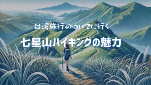
“How to get to Yangmingshan National Park / Mt. Qixing”
📝 Author’s Note
This blog was written by a Japanese traveler and translated into English as a part of my English study.
I hope it’s useful for other travelers, too!
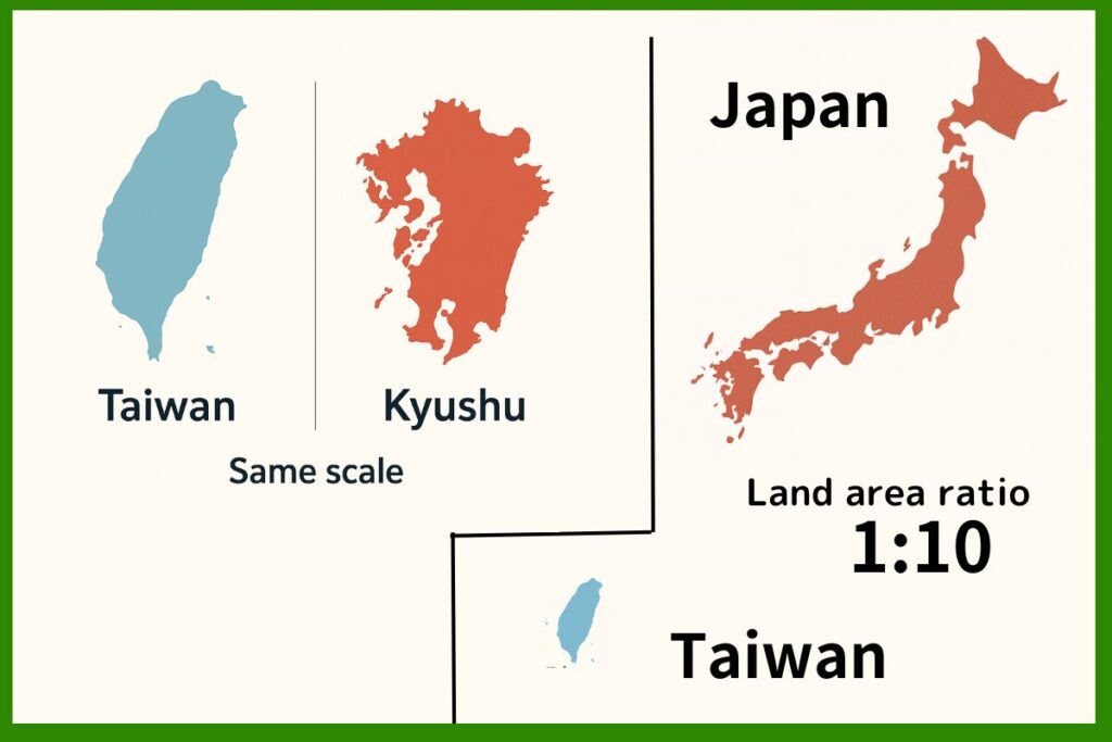
Apparently Taiwan has 268 mountains that are over 3,000 meters. In comparison, Japan has only 21.
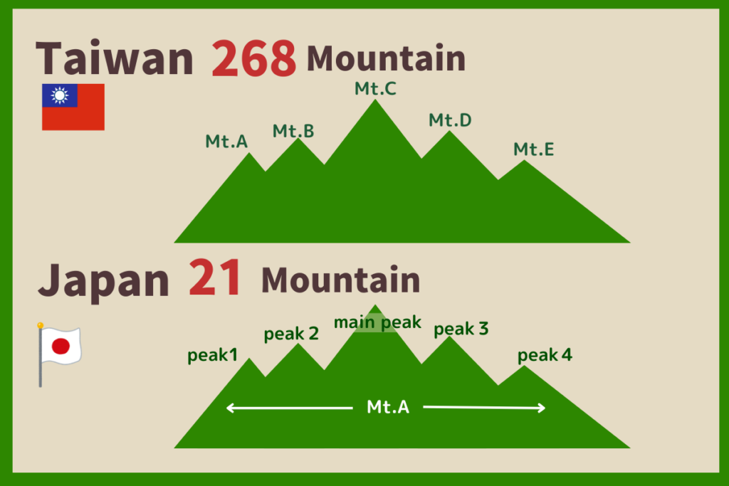
The way mountains are counted differs in Taiwan and Japan. In Taiwan, each peak is considered one mountain, but in Japan, some peaks that are close together are considered to be one mountain.
And yet, I get surprised that there are a lot of mountains in Taiwan because Taiwan’s land area is only one-tenth the size of Japan.
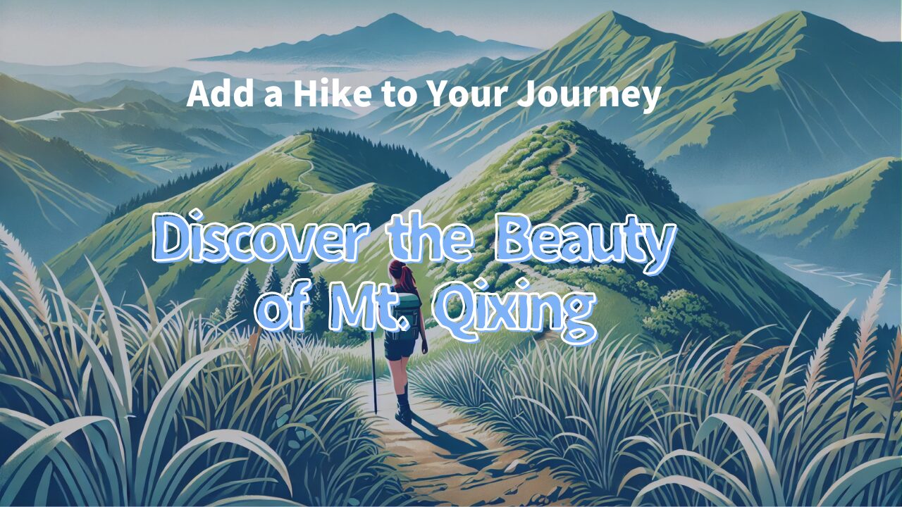
You can get to Mt. Qixing (1,120m) in one hour from Taipei. I heard it’s an easy walk even for beginners, so I went there too.
The area surrounding Mt. Qixing is called Yangmingshan. It is popular for hot spas.
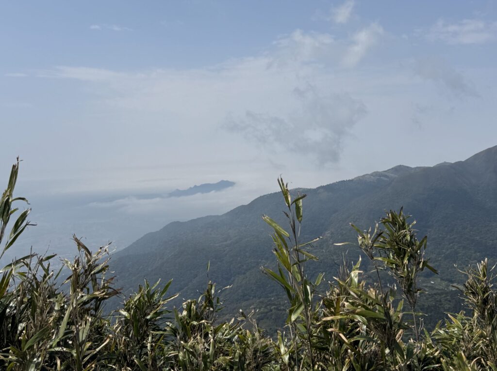
Popular sightseeing spots are connected by a 6.2km hiking trail. I walked along this trail, and at the top of the mountain I enjoyed a 360-degree view.
Let me show you the many highlights of the Yangmingshan hiking route.
🌍 Access and Hiking Guide to Mt. Qixing
🌄 How to get to Xiaoyoukeng (805m) from Taipei
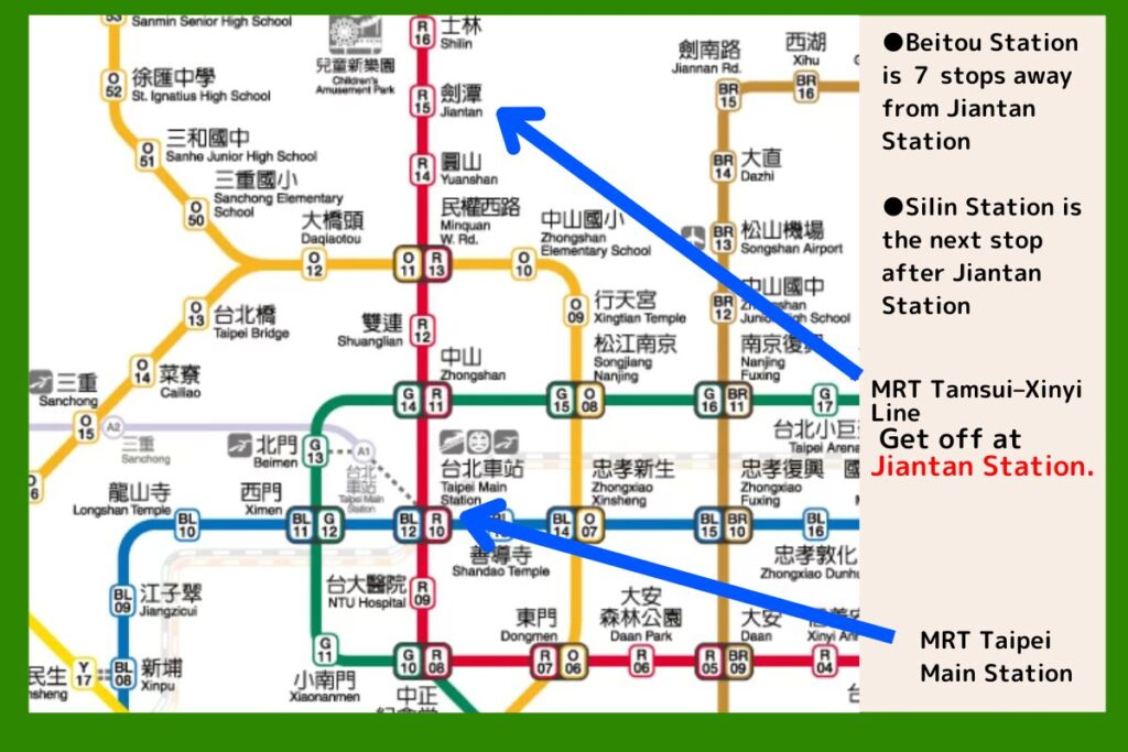
Transfer at Jiantan Station (劍潭)
- Take the MRT Tamsui-Xinyi Line and get off at Jiantan Station.
- The bus stop is near Exit 1. Take bus “S15”.
- Get off at Xiaoyoukeng Visitor Center (小油坑服務站).
🚌 Estimated time
- Taipei Station → Jiantan Station (MRT): about 10 minutes
- Jiantan Station → Xiaoyoukeng (bus): 40 – 50 minutes
🚍 Other access options
- Transfer at Shilin Station: Buses [255], [S15], [S9]
- Transfer at Beitou Station: Buses [230], [S9]
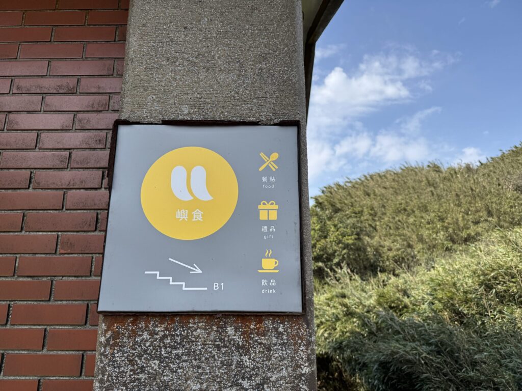
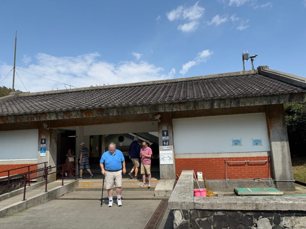
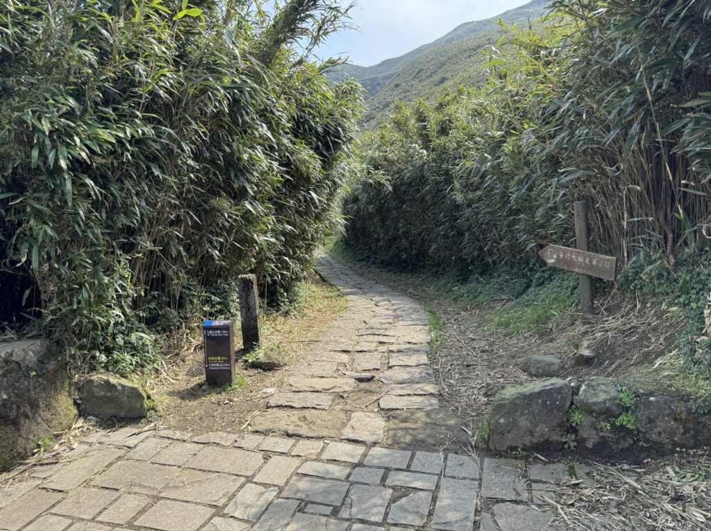
📍 Starting point: Xiaoyoukeng Visitor Center
Let’s get started! The trail begins right next to the bus stop.
Before you set off, use the restroom and pick up some drinks and trail snacks at the café to take with you — it’s important to carry food for energy during the hike.
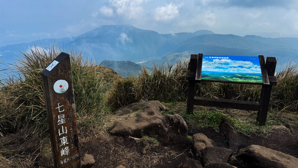
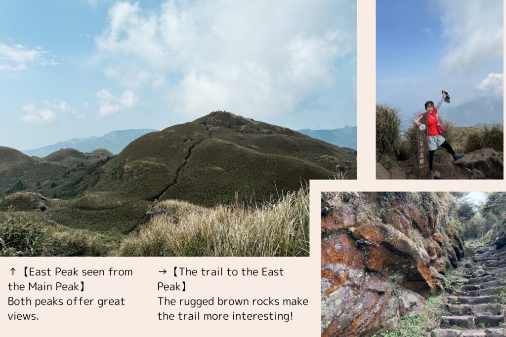
⛰ Two Peaks of Qixing Mountain
- Main Peak (1,120m)
- East Peak (1,107m)
Take a break at the Main Peak before continuing to the East Peak.
✨ Go to Dream Lake (980m)!
You’ll be rewarded with a fantastic view.
It’s a long downhill walk to Dream Lake from the East Peak. The trail offers great views and a sense of openness. However, there are steep stairs, so be careful.
🚶♂️ Choose your end point
- After visiting Dream Lake, you can head to Lengshuikeng.
- There’s a bus stop at Lengshuikeng, so you can finish your hike there.
- Or continue walking to the next spot, “Qingtiangang.”
I walked to Qingtiangang and returned to my hotel from there.
✨ Another route option
- Start at Qingtiangang and finish at Xiaoyoukeng (reverse route)
- You can skip the summit if you prefer
- The route is mostly flat except for the summit trail — easy for elderly hikers
- All sightseeing spots have bus stops, so it’s convenient to get around
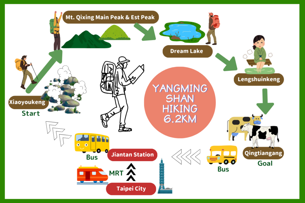
⛰️ Xiaoyoukeng (805m): Energy from nature
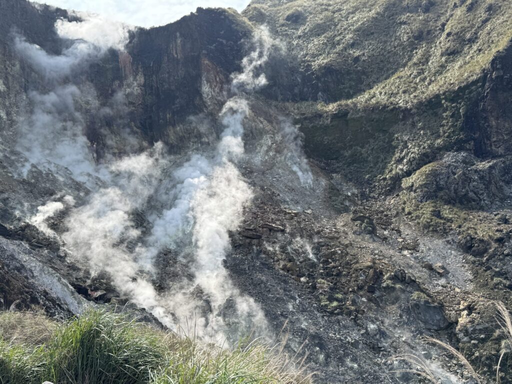
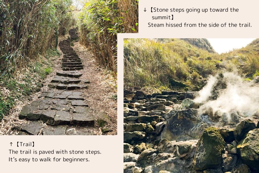
I felt as if the Earth’s magma was just beneath me. Gas was hissing from cracks, and the air smelled of sulfur.
It’s a place where you can really feel the energy of nature. Just don’t go beyond the fences — they are there for your safety.
🚶♂️ Short visit to Xiaoyoukeng
- Wheelchair-accessible path available (flat, no steps)
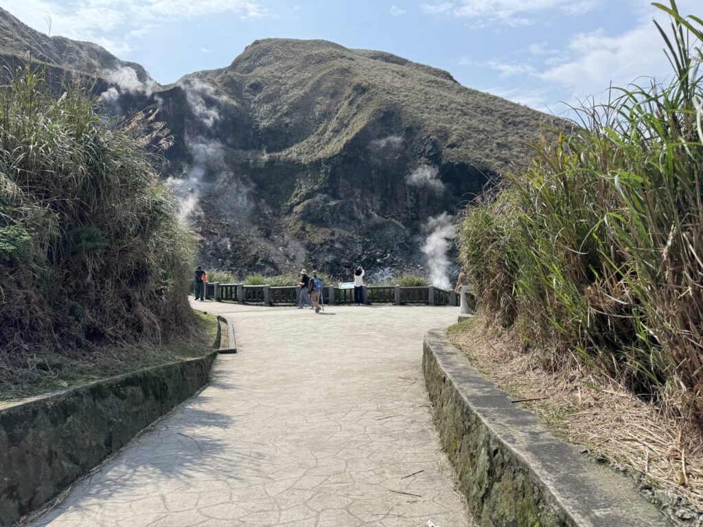
- Located right by the bus stop
- Perfect for a quick visit
⛰️ Mt. Qixing Hike Overview
The trail to the summit (1,120m) of Mt. Qixing starts at Xiaoyoukeng.
⛰️ Main Peak & East Peak: Spectacular views
- Distance: 1.6km to Main Peak
- Duration: About 1 hour
- Enjoy 300m walk from Main to East Peak (downhill then uphill)
⛰️ The charm of the mountain: 360° panorama!
You can see the city and sea from the top. Try to go on a clear day!
📏 Dream Lake (980m): Silent Reflections in a Hidden World
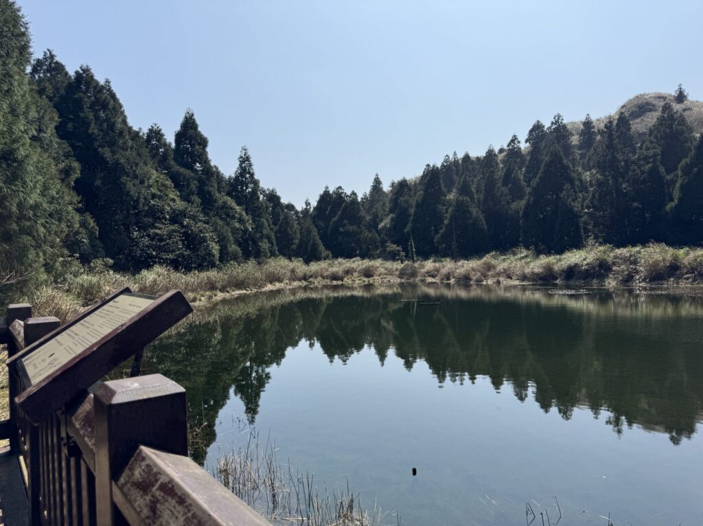
🌿 Features
- A lake formed in a volcanic crater
- Magical misty scenery
- Seasonal water level changes
🌸 Spring (Mar–May)
- Frequent rain fills the lake
- Fresh greenery surrounds the area
☀️ Summer (Jun–Aug)
- Low rainfall, lake may dry up
🍂 Autumn (Sep–Nov)
- Typhoons and rain raise the water level
- Silver grass sways in the wind
❄️ Winter (Dec–Feb)
- Northeastern winds bring rain
- Lake reaches highest level
- Misty, mysterious views
🚶♂️ Easy access
- Bus stop nearby
- Can be visited without hiking to the summit
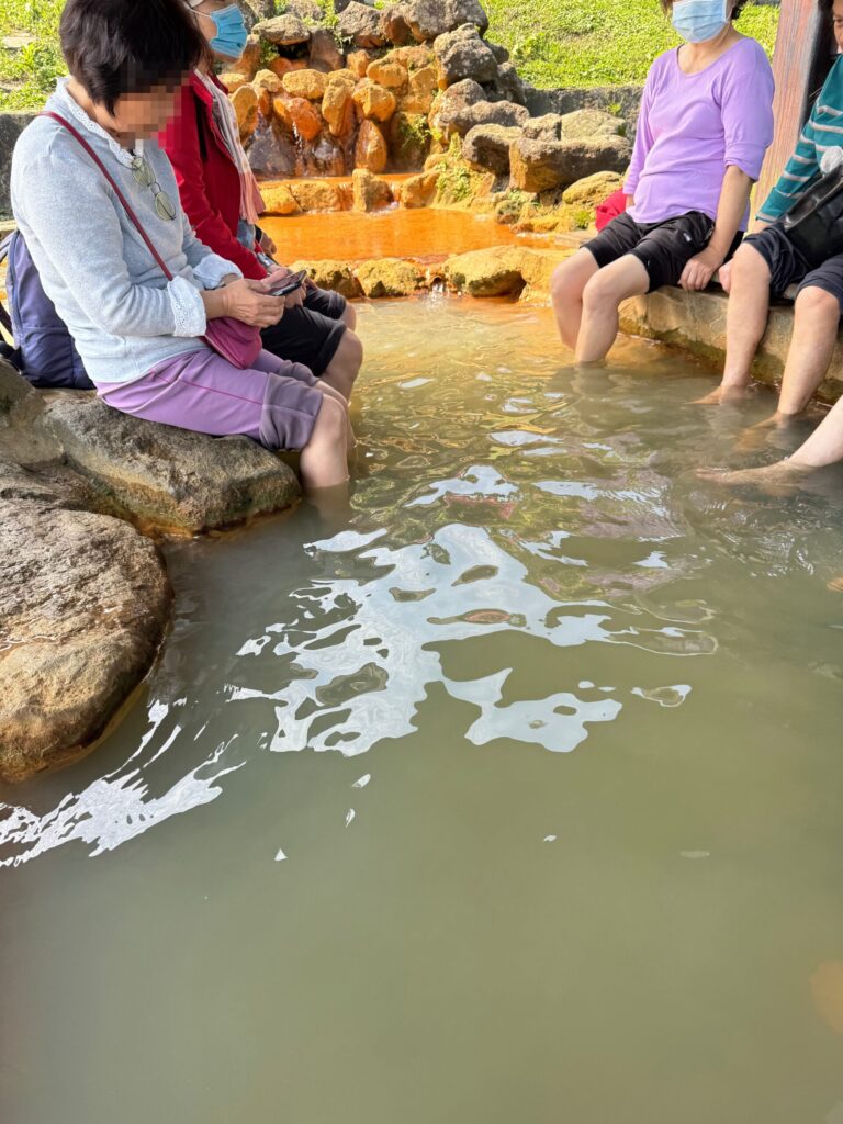
⛺ Lengshuikeng (740m): Refresh with a foot bath!
I recommend relaxing your feet here when tired.
“Lengshuikeng” means “cold water,” but the foot bath is warm and comfortable.
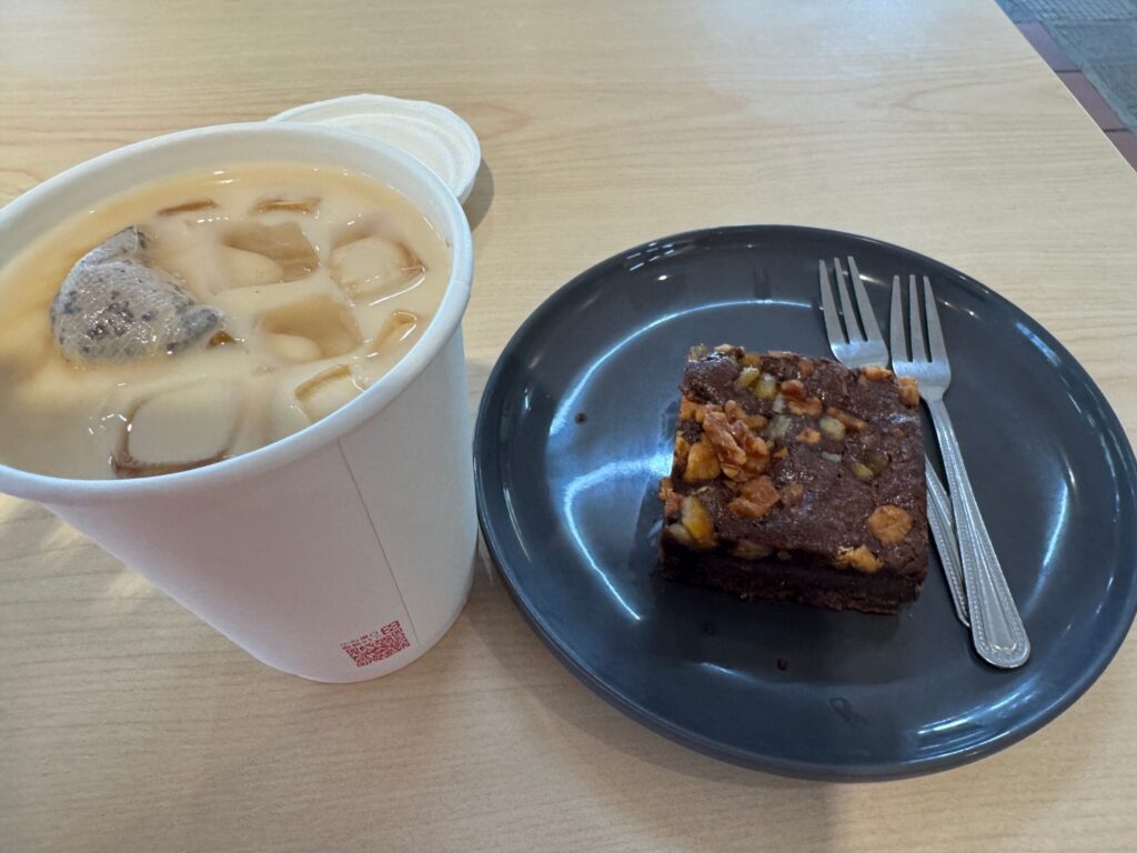
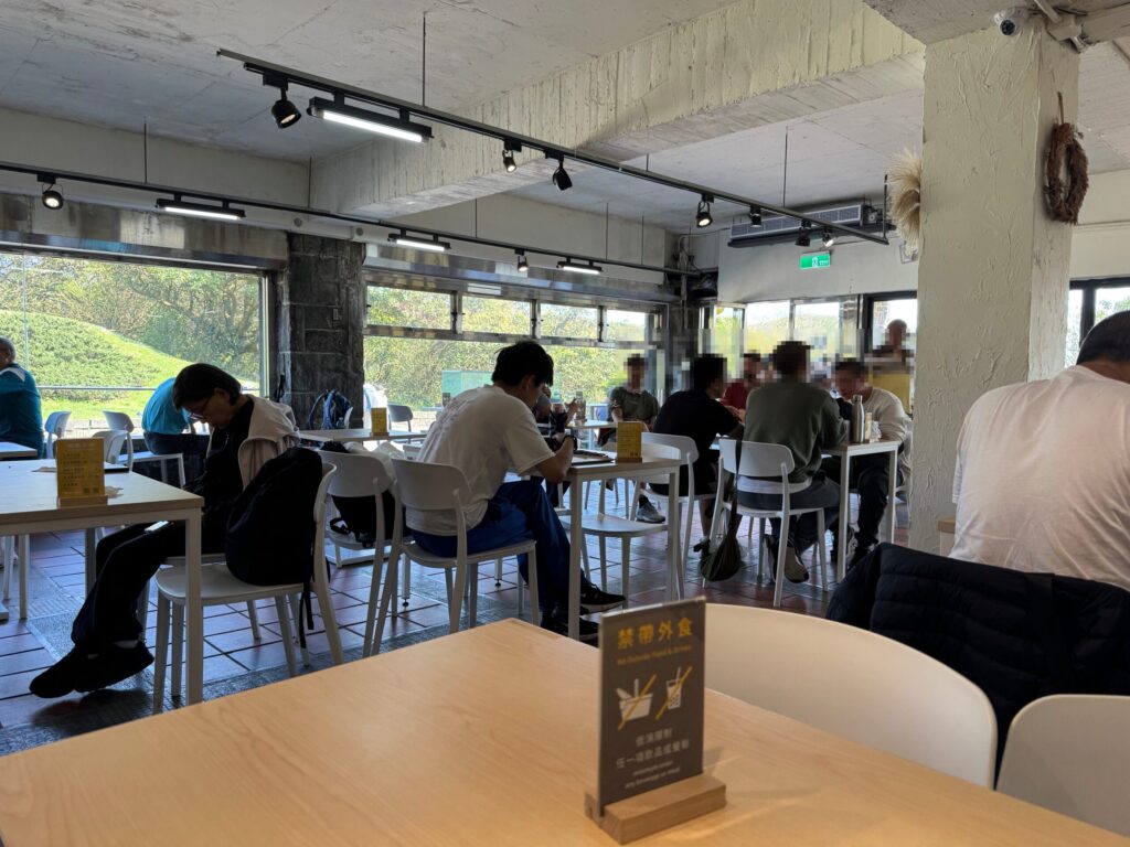
🍽️ Take a break at the cafe
Enjoy light meals and drinks. A cold drink and cake feel great after a long walk.
🚶♂️ Stop by Milk Lake
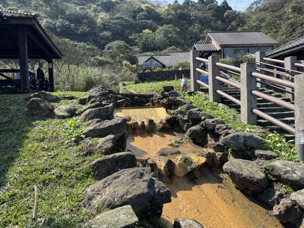
Milk Lake is near the parking lot. Its color is mysteriously beautiful.
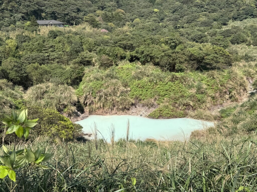
Milk Lake turns white mainly because of volcanic sulfur rising from the lake bed. The sulfur mixes with water and minerals, creating the mysterious milky appearance.
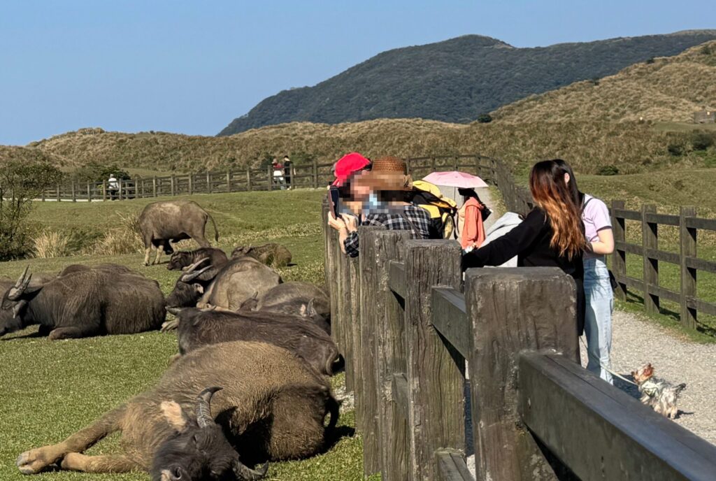
🌾 Qingtiangang (760m): Open Grassland
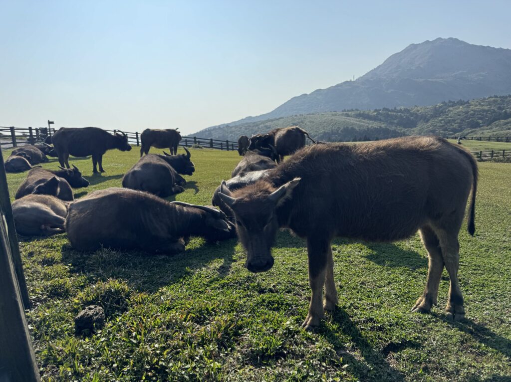
This area used to be a large ranch during the Japanese rule in 1934.
The cows in those years were helpful for farm work.
Through agricultural mechanization, farmers don’t need cows anymore.
But even now, many cows still live here.
🐂 Be careful when sightseeing
- Don’t get too close
- Don’t feed the cows
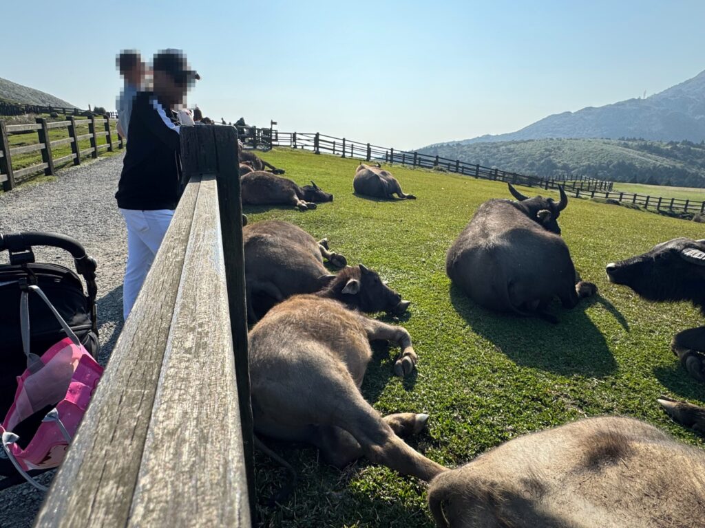
🚗 Easy access
- Nearby parking
- Suitable for strollers and babies
- Bus stop available
🏕️ Summary: Hiking in Mt. Qixing
You can reach this beautiful area within one hour from Taipei.
- Easy hike for beginners
- Seasonal scenery
- Great views
- Hot spas and local food
Let’s wear comfortable old shoes — many stone steps are waiting!
Hiking, scenic views, hot springs, and good food are always fun.
Add this route to your Taiwan trip!
👕 Clothing and Equipment
- Quick-drying clothes are best (you will sweat)
- When I travel, I always wear hiking-specific clothing and shoes with good grip.
- I washed them at night at my hotel and they dried by morning
- My non-slip shoes were helpful even on wet cobblestones in Europe
📘 Author’s Note
I’m still learning English, so thank you for your patience!
I’ll keep sharing my travel stories in English, one step at a time.
You can also find more detailed posts in Japanese on my main blog.
よろしくお願いします! (Thank you for your support!)

コメント